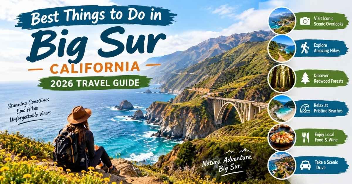
things to do in big sur california include driving the legendary Highway 1, seeing McWay Falls, exploring Pfeiffer Beach, walking beneath coastal redwoods, touring Point Sur Lighthouse, and watching whales, sea otters, and California condors along the Pacific coast. However, the best Big Sur trip is not the one with the most stops. Choose a few meaningful experiences, check current road conditions, and leave room for fog, traffic, full parking lots, and unexpected views.
Big Sur is not one compact town. It is a roughly 90-mile stretch of rugged coastline between the Monterey Peninsula and northern San Luis Obispo County. Highway 1 connects its beaches, forests, restaurants, state parks, and scenic overlooks. A single closure can completely change what is practical in one day.
This guide organizes the best things to do in Big Sur by location. It also explains how long each attraction takes, who it suits, what it may cost, and when you should choose an alternative.
Important: Highway 1, park, trail, and campground conditions can change because of landslides, wildfire operations, storms, or maintenance. Check Caltrans and individual park alerts on the morning of your trip.
Big Sur at a Glance
| Planning question | Practical answer |
|---|---|
| How much time do you need? | One full day for selected highlights; two days for a relaxed visit |
| Do you need a car? | Yes, unless you book a guided Big Sur tour |
| Can you drive the entire coast? | Only when Highway 1 is fully open |
| Is cell service reliable? | No; download offline maps before arriving |
| Is Big Sur free? | The drive and some viewpoints are free, but parks and beaches may charge fees |
| Best driving direction | North to south often makes ocean-side access easier |
| Best starting time | Early morning, especially on weekends |
| Main travel risks | Closures, illegal parking, fog, rough surf, fire, and driving after dark |
Check Conditions Before Choosing Your Stops
Big Sur travel guides become outdated faster than ordinary destination guides. Landslides, wildfires, damaged trails, heavy surf, and maintenance work can affect access with little notice.
Before driving, check:
- Caltrans QuickMap for Highway 1 closures and construction
- California State Parks for park and trail conditions
- Los Padres National Forest for fire restrictions and forest closures
- The local weather forecast for fog, rain, heat, and strong wind
- The tide forecast before visiting beaches, coves, or tide pools
Save screenshots of essential information because mobile coverage is unreliable. Road signs, closure gates, and instructions from emergency personnel always override an online itinerary.
When Should You Postpone Your Big Sur Drive?
Postpone the trip if emergency agencies ask visitors to stay away, an evacuation order affects your route, or the only access road to your planned attractions is closed.
Heavy smoke, flooding, falling-rock warnings, and severe wind can also make Highway 1 dangerous. In Big Sur, good judgment matters more than completing a bucket list.
Best Big Sur Attractions Compared
| Experience | Best for | Time needed | Walking | Cost level | Main limitation |
|---|---|---|---|---|---|
| Highway 1 scenic drive | First-time visitors | Half to full day | Minimal | Free plus fuel | Closures and traffic |
| Garrapata coastal trails | Views and short hikes | 1–2 hours | Easy to moderate | Free | Limited parking |
| Bixby Creek Bridge | Iconic scenery | Drive-by stop | None required | Free | Congestion and restrictions |
| Point Sur Lighthouse | History lovers | 2–3 hours | Steep walk | Paid tour | Limited schedule |
| Pfeiffer Big Sur State Park | Redwoods and families | 2–4 hours | Easy to moderate | Day-use fee | Trail conditions vary |
| Pfeiffer Beach | Sunset and photography | 1–2 hours | Short walk | Day-use fee | Narrow road and limited lot |
| Nepenthe | Food with a view | 1–2 hours | Minimal | Moderate to high | Waits and coastal fog |
| McWay Falls | Classic Big Sur scenery | 30–60 minutes | Short walk | Park fee | No beach access |
| Partington Cove | Active travelers | 1.5–2 hours | Steep | May require a fee | Limited parking |
| Limekiln State Park | Redwoods and history | 2–3 hours | Easy to moderate | Day-use fee | Services may be limited |
| Sand Dollar Beach | Beachcombing and picnics | 1–3 hours | Stairs | Day-use fee | Rough surf and tides |
Northern Big Sur Attractions Near Carmel
Northern Big Sur is the most practical area for a short trip from Carmel-by-the-Sea or Monterey. It combines wildlife, coastal trails, Bixby Creek Bridge, and Point Sur without requiring you to reach the remote southern coast.
1. Explore Point Lobos State Natural Reserve
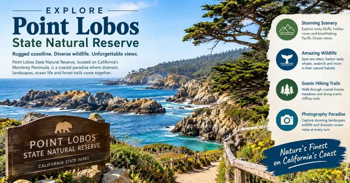
Point Lobos sits just south of Carmel and is often treated as the natural beginning of a Big Sur road trip. Although it lies north of the central Big Sur coast, its rocky coves, cypress trees, kelp forests, and wildlife make it one of the region’s most rewarding attractions.
The reserve contains several interconnected walking trails. China Cove and Bird Island are excellent choices for turquoise water, dramatic cliffs, and possible harbor-seal sightings. Shorter coastal paths suit visitors who do not want a demanding hike.
Bring binoculars for sea otters, migrating whales, seabirds, and harbor seals. Never approach or disturb resting wildlife.
Parking inside Point Lobos is limited and can fill early. Arriving near opening time is easier than circling during the middle of the day. Dogs are not permitted, and accessibility differs between viewpoints and paths.
Allow: Two to four hours.
Best for: Wildlife lovers, photographers, couples, and families.
Alternative if full: Continue south to the coastal trails at Garrapata State Park.
2. Walk the Garrapata Coastal Bluffs
Garrapata State Park delivers the wild scenery many travelers imagine when planning a Big Sur vacation. Expect wind-shaped vegetation, rocky headlands, narrow coves, coastal wildflowers, and uninterrupted Pacific Ocean views.
The western side of Highway 1 contains relatively short coastal paths. Trails east of the highway climb toward the Santa Lucia Mountains and require more time and effort.
Garrapata does not feel like a conventional park with one large entrance. Access points are distributed along the highway, making advance route research important. Park only where your vehicle fits completely outside the travel lane.
During spring, the area near Calla Lily Valley may bloom with white flowers. Remain on established paths. Walking through the flowers for photographs damages plants and contributes to erosion.
Allow: One to two hours for a coastal walk.
Best for: Short hikes, wildflowers, coastal photography, and free Big Sur activities.
3. See Rocky Creek Bridge
Rocky Creek Bridge is often mistaken for Bixby Creek Bridge because both are graceful concrete arches surrounded by rugged coastal scenery.
Recognizing the difference prevents a common first-time visitor mistake: stopping at Rocky Creek and assuming you have already reached Big Sur’s most famous bridge.
Treat Rocky Creek primarily as part of the scenic drive. Stop only in an established turnout where parking is clearly permitted. If no safe space is available, continue driving.
4. Experience Bixby Creek Bridge Responsibly
Bixby Creek Bridge is one of the most recognizable landmarks on California’s Highway 1. Its concrete arch spans a steep canyon with the Pacific Ocean visible beyond it.
Unfortunately, its popularity creates traffic congestion and unsafe parking. Never stop in a traffic lane, make an abrupt U-turn, block Old Coast Road, or walk onto the narrow bridge for a photograph.
Follow all posted parking restrictions. If no legal space is available, experience the bridge by driving across it while keeping your attention on the road.
The bridge does not need to become a stressful checklist item. Garrapata and other legal viewpoints can provide equally memorable coastal scenery without the same congestion.
Allow: A few minutes as part of your scenic drive.
Local tip: Visit early, but never assume early arrival makes prohibited parking acceptable.
5. Tour Point Sur Lighthouse
The historic Point Sur Lighthouse stands on a dramatic volcanic rock formation rising above the coastline. The lighthouse began operating in 1889 and represents the difficult maritime history of this isolated stretch of California.
Unlike an ordinary roadside attraction, Point Sur is generally visited through a scheduled guided tour. The experience involves a steep uphill walk and exposure to wind, sun, and rapidly changing coastal weather.
Wear secure walking shoes and bring a jacket, even if the day begins warm. Families should confirm current age requirements and tour conditions before arriving.
Point Sur is especially worthwhile for travelers who want to understand Big Sur beyond its scenery. Stories about lighthouse keepers, shipwrecks, and coastal navigation add important historical context.
Allow: Two to three hours.
Best for: History enthusiasts, older children, photographers, and guided-tour travelers.
Central Big Sur: Redwoods, Beaches, Food, and Culture
Central Big Sur provides the region’s best combination of redwood forest, river scenery, restaurants, accommodation, and cultural attractions. It is where your itinerary can slow down and feel like a real visit instead of a sequence of quick photographs.
6. Walk Beneath Redwoods at Pfeiffer Big Sur State Park
Pfeiffer Big Sur State Park sits inland around the Big Sur River. It does not provide direct beach access, but it offers shaded forest, picnic areas, camping, river scenery, and hiking trails beneath coast redwoods.
When open, the Pfeiffer Falls and Valley View trails are popular choices. Trail conditions can change after fires or winter storms, so verify accessible routes before relying on an older map.
This is one of the best places to spend several hours rather than making another brief roadside stop. Families may appreciate the river setting and facilities, while hikers can explore a longer section of the trail network.
Dogs are restricted from many trails, so confirm the current pet policy before visiting.
Allow: Two to four hours.
Best for: Families, redwood walks, picnics, camping, and warm-weather shade.
Do Not Confuse the Three Pfeiffer Attractions
| Place | What it is | Why you should visit |
|---|---|---|
| Pfeiffer Big Sur State Park | Inland state park | Redwoods, river, hiking, and camping |
| Pfeiffer Beach | National forest day-use beach | Purple sand, Keyhole Arch, and sunset |
| Julia Pfeiffer Burns State Park | Coastal state park farther south | McWay Falls overlook |
These attractions have different entrances, fees, operating conditions, and rules. Searching your navigation app for only “Pfeiffer” can send you to the wrong place.
7. Visit Pfeiffer Beach and Keyhole Arch
Pfeiffer Beach is known for patches of purple-toned sand and Keyhole Arch, a large rock formation that can frame the setting sun during a limited period in winter.
Even outside the famous Keyhole Arch sunset season, this beach feels wild and visually distinctive. Powerful waves, offshore rocks, and rugged cliffs create excellent photography conditions.
You reach Pfeiffer Beach by turning onto Sycamore Canyon Road. The entrance can be easy to miss, and the road is narrow. Large RVs and trailers may be restricted.
The parking lot has limited capacity. If attendants close access, do not wait illegally along Highway 1.
The water is cold, and waves can be forceful. Treat Pfeiffer Beach as a destination for walking, watching the ocean, picnicking, and photography—not as a reliably safe swimming beach.
Allow: One to two hours, plus possible entrance delays.
Best time: Late afternoon for warm light, but arrive before the parking area fills.
8. Relax Beside the Big Sur River
The Big Sur River Inn provides a relaxing contrast to the exposed coastline. Depending on water and seasonal conditions, visitors can eat, rest near the river, or enjoy the grassy area beside the property.
This is a practical midday stop because it combines food, facilities, and a break from driving. For families, that pause can be more valuable than squeezing another overlook into the itinerary.
Always supervise children around the water, even when the river appears shallow or calm.
9. Stop at Big Sur Bakery
Big Sur Bakery is a popular place for coffee, baked goods, breakfast, and more substantial meals. It works best as a planned stop early in the day rather than an impulsive visit during the busiest lunch period.
Business hours can change seasonally. Verify opening times before designing your itinerary around a specific meal.
Carry water and snacks regardless. Big Sur has fewer food options than many visitors expect, and reaching the “next restaurant” may take longer than a navigation app suggests.
10. Eat Above the Pacific at Nepenthe
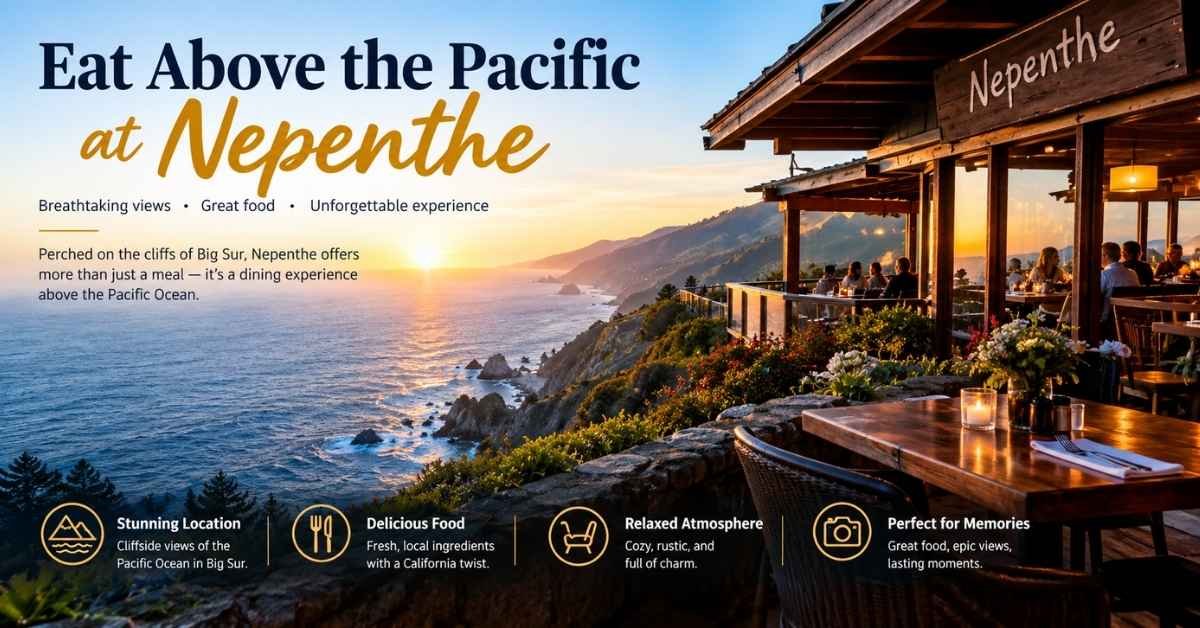
Nepenthe is one of Big Sur’s most recognizable restaurants. Its terrace overlooks the Pacific, while its famous Ambrosia burger has become almost as well known as the scenery. Cafe Kevah provides another dining option within the same complex.
Expect premium prices and possible waits. On a clear afternoon, the dramatic setting can make both worthwhile. If coastal fog hides the view, decide whether the atmosphere and history still justify the stop for you.
If you are driving, avoid turning a scenic lunch into a road-safety problem. Choose a nonalcoholic drink or limit alcohol before returning to Highway 1.
Allow: One to two hours.
Best for: Couples, first-time visitors, sunset views, and memorable meals.
11. Browse the Henry Miller Memorial Library
The Henry Miller Memorial Library is a small cultural center surrounded by redwoods. It preserves Big Sur’s connection with writers, artists, music, books, and independent thought.
This is a refreshing stop during a foggy afternoon or when you need a break from exposed coastal viewpoints. Events, concerts, screenings, and performances may require advance tickets.
Opening times can vary, so check the current schedule before visiting.
Allow: Around 30 minutes for a casual visit or longer for an event.
Southern Big Sur: Waterfalls, Beaches, and Wild Coastline
Southern Big Sur becomes increasingly remote. Its waterfalls, state parks, beaches, and open coastal landscapes are unforgettable, but access depends heavily on Highway 1 conditions.
Never assume an attraction visible on a map can be reached from both directions.
12. See McWay Falls From the Official Overlook
McWay Falls drops approximately 80 feet toward a protected cove in Julia Pfeiffer Burns State Park. It is one of the most photographed Big Sur landmarks.
The actual experience is simpler than some travel photos imply. Visitors view the waterfall from an official overlook rather than hiking down to the beach.
Beach access below McWay Falls is prohibited. The cliffs are unstable, and attempting to descend damages a sensitive environment while placing you at serious risk.
The overlook is normally reached by a short walk, but sections of the path can close because of repairs or storm damage. Check the current park status before driving south specifically for the waterfall.
Afternoon light may illuminate the cove more effectively than early morning, although fog can affect visibility at any hour.
Allow: Thirty to sixty minutes.
Best for: First-time visitors, short walks, photographers, and non-hikers.
13. Hike to Partington Cove
Partington Cove suits travelers who want a short but energetic hike. The route descends from Highway 1, crosses forested terrain, and passes through a historic tunnel before reaching a rocky cove.
The main challenge is the return journey. A descent that feels easy at the beginning becomes a steep uphill climb later.
Wear shoes with grip, carry water, and watch for poison oak. Do not treat the trail as a quick ten-minute stop.
Parking near the trailhead is limited. If your vehicle cannot fit completely within a legal parking space, continue to your alternative destination.
Allow: Ninety minutes to two hours.
Best for: Active couples, older families, hikers, and coastal history.
14. Explore Limekiln State Park
Limekiln State Park combines several sides of Big Sur in one compact destination. It contains redwood forest, a coastal creek, historic lime kilns, a waterfall, and access to the ocean.
The preserved kilns recall the nineteenth-century industry that once used local limestone and redwood fuel to produce construction materials.
This variety makes Limekiln especially useful on a two-day Big Sur itinerary. You can experience history and forest scenery without committing to a long backcountry hike.
Trails and facilities have repeatedly been affected by fires, storms, and road closures. Always verify current access before visiting.
Allow: Two to three hours.
Best for: History, redwoods, waterfalls, camping, and nature walks.
15. Walk Along Sand Dollar Beach
Sand Dollar Beach is one of the longest publicly accessible beaches along the Big Sur coast. A trail and stairway descend from the day-use area to the sand.
Check the tide forecast before visiting. High water can reduce available beach space, while powerful surf and rip currents make swimming dangerous.
The stairs also create a genuine accessibility barrier. Travelers with mobility limitations should consider a more accessible coastal overlook.
On a calm afternoon, Sand Dollar Beach is excellent for picnicking, beachcombing, photography, and watching light change across the offshore rocks.
Allow: One to three hours.
Best for: Beach walks, couples, picnics, and sunset photography.
16. Enjoy the Open Coast at Pacific Valley
Pacific Valley offers expansive coastal views without the facilities or crowds of central Big Sur. When accessible, short bluff walks provide space to watch the ocean, photograph the landscape, and search for migrating whales.
The area is exposed to wind and changing weather. Bring layers, drinking water, and enough fuel to avoid depending on an uncertain next stop.
During an active Highway 1 closure, Pacific Valley may become the point where through-travel ends. Obey all closure gates and never attempt an unofficial detour.
17. Continue to Gorda and Ragged Point When Access Allows
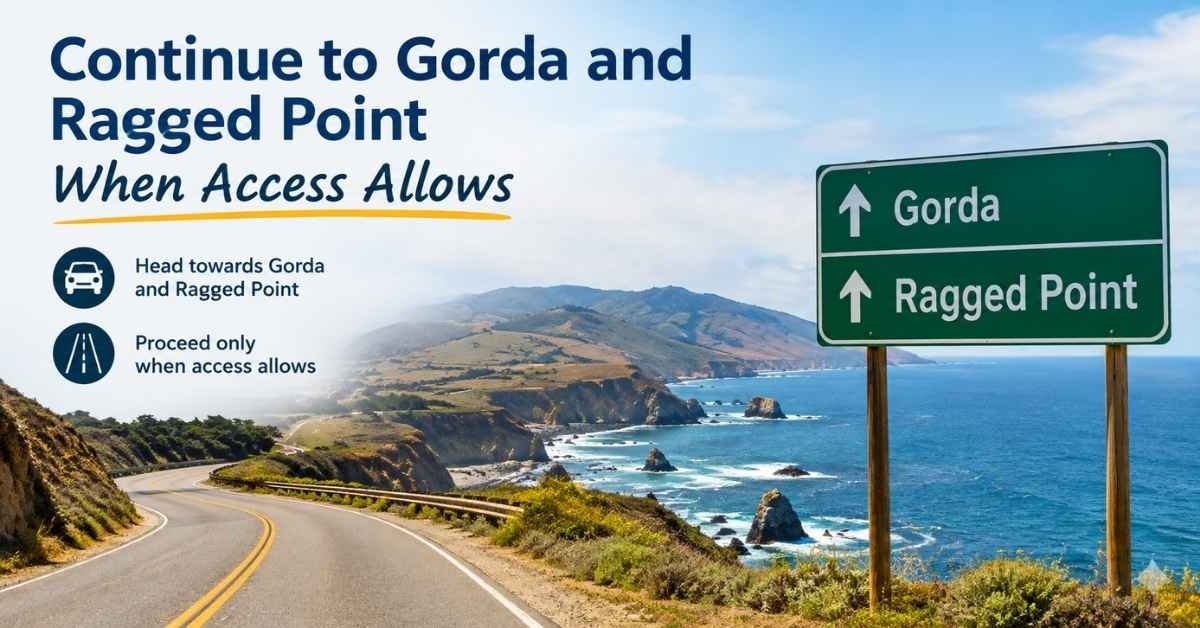
Gorda and Ragged Point provide southern anchors for food, fuel, facilities, and ocean views. They are not quick additions to a central Big Sur itinerary. Distances are substantial, and average driving speeds are slow.
Ragged Point includes gardens, panoramic coastal scenery, and a steep waterfall trail. Check the trail condition before descending.
If you plan to return north, calculate the entire drive back before starting another activity.
More Unique Things to Do in Big Sur
Look for California Condors
The California condor is North America’s largest land bird and one of Big Sur’s most important conservation stories.
Its enormous wingspan, steady soaring pattern, and numbered wing tags help distinguish it from a turkey vulture. Bring binoculars and scan thermal currents above ridges and coastal canyons.
The Ventana Wildlife Society has played an important role in condor recovery and provides valuable educational context.
Never approach, feed, follow, or disturb wildlife for a closer photograph.
Watch for Whales and Sea Otters
Big Sur’s elevated coastline allows visitors to watch marine life without boarding a boat.
Gray whales migrate along the coast during winter and spring. Humpback and blue whale sightings may be possible during their respective seasons. Sea otters sometimes appear in offshore kelp beds, particularly closer to the Monterey Peninsula.
Wildlife sightings are never guaranteed. Treat them as a memorable bonus rather than building your entire day around a promised encounter.
The Piedras Blancas elephant seal rookery near San Simeon is frequently included in Big Sur road trips. However, it lies beyond the core Monterey County section of Big Sur, so include additional driving time.
Camp Beneath Redwoods or Near the Ocean
Camping in Big Sur ranges from developed state park sites to national forest campgrounds and private riverside properties.
Popular options may include:
- Pfeiffer Big Sur State Park
- Plaskett Creek Campground
- Kirk Creek Campground
- Riverside Campground and Cabins
- Fernwood Campground and Resort
- Treebones Resort
Campsites can sell out far in advance, especially during summer and holiday weekends. Reserve early and confirm vehicle-length restrictions, generator rules, fire regulations, and current access.
Sleeping in an unapproved roadside pullout is not a substitute for a legal campsite. Dispersed camping rules are often misunderstood, and forest closures can restrict access.
Stay in a Cabin, Yurt, or Luxury Retreat
Big Sur accommodation covers an unusually wide range of experiences:
- Big Sur Lodge offers a central forest setting
- Treebones Resort is known for yurts and an eco-retreat atmosphere
- Alila Ventana Big Sur combines luxury with redwood surroundings
- Post Ranch Inn emphasizes privacy, architecture, and ocean views
- Private campgrounds and cabins offer simpler stays near the river
Prices can be high because accommodation is limited and operating in a remote region is expensive.
Budget-conscious travelers can stay in Carmel or Monterey to the north, or Cambria and San Simeon to the south, provided the current Highway 1 configuration supports the planned route.
Understand Esalen Before Planning a Visit
The Esalen Institute is a retreat and educational center associated with wellness, psychology, creativity, and the human-potential movement.
It is not a conventional roadside spa where visitors can automatically arrive and use the hot springs. Access usually requires a workshop, reservation, or specifically offered program.
Confirm the current rules directly rather than relying on an old article describing nighttime hot-spring access.
Experience Big Sur’s Literary and Artistic Character
Big Sur has long attracted writers, photographers, architects, artists, and people seeking solitude.
Henry Miller lived in the region, Jack Kerouac wrote about it, and local venues continue to host books, music, visual art, and cultural events.
Including this cultural layer makes a visit feel less like a race between scenic viewpoints. A library visit, gallery, concert, or quiet meal may become more memorable than another crowded photograph.
Realistic Big Sur Itineraries
Four-Hour Big Sur Itinerary From Carmel or Monterey
If you only have four hours, remain in northern Big Sur:
- Start early at Point Lobos or Garrapata.
- Choose one meaningful coastal walk instead of rushing through both parks.
- Continue south along Highway 1.
- Drive across Bixby Creek Bridge without making an illegal stop.
- Visit one additional legal coastal turnout.
- Turn around early enough to return before darkness.
Do not attempt to add McWay Falls, Limekiln, and Sand Dollar Beach to this short schedule. Driving distances, slow traffic, and limited parking will consume the available time.
One-Day Big Sur Itinerary
A satisfying one-day Big Sur road trip needs approximately five anchor experiences:
- 7:30–9:30 a.m.: Walk at Point Lobos or Garrapata.
- 9:30–10:30 a.m.: Enjoy the Highway 1 scenic drive and cross Bixby Creek Bridge.
- 10:45 a.m.–12:45 p.m.: Take a redwood walk at an open central Big Sur park.
- 1:00–2:30 p.m.: Eat at Big Sur River Inn, Big Sur Bakery, Nepenthe, or another open restaurant.
- 3:00–5:00 p.m.: Choose Pfeiffer Beach, McWay Falls, or Partington Cove if access and daylight permit.
Add a 25–35% time buffer for traffic, parking, construction, and spontaneous viewpoints. Remove an attraction before removing your safety margin.
Two-Day Big Sur Itinerary
Day One: Northern Coast and Central Redwoods
- Point Lobos or Garrapata
- Highway 1 scenic drive
- Bixby Creek Bridge
- Point Sur Lighthouse tour or central redwood hike
- Dinner or sunset in central Big Sur
Day Two: Waterfalls and Southern Coast
- McWay Falls
- Partington Cove or Limekiln State Park
- Sand Dollar Beach
- Pacific Valley or Ragged Point if accessible
Two days give you enough time for a meaningful hike, a relaxed meal, wildlife watching, and a beach visit without turning Highway 1 into a race.
What to Do When Highway 1 Is Partially Closed
Build the entire day within the accessible section.
From the north, create a Carmel-based itinerary using Point Lobos, Garrapata, Bixby Creek Bridge, central Big Sur, and officially open attractions before the closure.
From the south, use Cambria or San Simeon as your base and visit reachable southern destinations.
Never follow a navigation app onto private, unpaved, or unsuitable roads to bypass a closure. When Caltrans recommends US 101, use the official alternative.
Things to Do in Big Sur Without Hiking
You can experience Big Sur without taking a long trail. Consider:
- Driving Highway 1
- Visiting legal scenic overlooks
- Using short accessible paths where available
- Relaxing beside the Big Sur River
- Eating at Nepenthe or another scenic restaurant
- Visiting the Henry Miller Memorial Library
- Joining a guided historical tour
- Watching wildlife from safe viewpoints
Remember that “no hiking” does not automatically mean wheelchair accessible. Confirm path surfaces, slopes, steps, restrooms, and accessible parking before arriving.
Family-Friendly Big Sur Itinerary
Families should prioritize fewer attractions with restrooms, picnic space, short walks, and safe parking.
A redwood or river experience followed by a coastal viewpoint is usually more enjoyable than repeatedly loading children into the car.
Pack:
- Food and water
- Warm layers
- Sun protection
- Motion-sickness supplies
- A basic first-aid kit
- Offline entertainment for slow traffic
Keep children away from cliff edges, surf zones, and Highway 1 shoulders. If parking requires a dangerous road crossing, choose another attraction.
Big Sur Photography Itinerary
Do not design the entire photography trip around sunset.
Morning fog can soften forest light. Afternoon sunlight may illuminate McWay Cove. Winter sunsets can align with Keyhole Arch, while spring may bring coastal flowers.
Check three variables before leaving:
- Fog and cloud cover
- Tide and surf conditions
- Legal parking and current access
A photograph is never worth stopping in a travel lane, entering private property, approaching wildlife, or stepping onto an unstable cliff.
How to Plan a Big Sur Road Trip
Choose Your Direction Before Choosing Attractions
Driving north to south often places the ocean and many coastal turnouts on the passenger side. This can reduce the need to cross traffic.
However, it is not automatically the correct direction for every trip. Your accommodation, Highway 1 status, daylight, and turnaround point matter more.
If you are returning to Monterey, do not plan as though you are continuing to Cambria. If you begin near San Simeon, reverse the itinerary and confirm how far north the road is open.
Stay Within One Geographic Cluster
A one-day visitor should not attempt every famous bridge, beach, waterfall, restaurant, and hiking trail.
Choose:
- One coastal anchor
- One redwood or river experience
- One meal or cultural attraction
- One flexible scenic viewpoint
This framework reduces backtracking and makes the day feel spacious instead of frantic.
Download Essential Information
Before losing cell service, save:
- An offline regional map
- Current road-closure screenshots
- Park addresses and operating information
- Tour and accommodation confirmations
- Fuel and restroom locations
- Emergency contact details
- Directions back to your accommodation
Do not assume every restaurant, hotel, or visitor center will offer dependable public Wi-Fi.
Establish a Firm Turnaround Time
Highway 1 becomes more difficult after dark, especially for visitors unfamiliar with its narrow curves and unlit sections.
Choose the latest time you will begin your return journey. Consider sunset, fog, fuel, construction, and the confidence of the least-experienced driver in your group.
Parking, Fuel, Restrooms, and Cell Service
Big Sur Parking Requires Patience
Parking pressure is greatest around Point Lobos, Pfeiffer Beach, major state parks, and popular trailheads.
Some Big Sur attractions use small roadside areas instead of conventional parking lots.
Follow three essential rules:
- Your vehicle must fit completely within a legal space.
- Never block a gate, driveway, bicycle lane, or emergency route.
- If the area is full, visit your planned alternative instead of waiting in traffic.
Fill Your Tank Before Entering Big Sur
Fuel is available at limited locations and often costs more than in Monterey, Carmel, Cambria, or San Simeon.
Begin your drive with a full tank. Do not enter a remote section while depending on a single station being open.
Electric-vehicle drivers should verify charger location, compatibility, availability, and the distance required to return.
Plan Your Restroom Stops
Restrooms may be available at open state parks, day-use areas, restaurants, fuel stops, and visitor facilities.
Operating changes can affect access. Use a restroom when a legitimate opportunity appears rather than assuming the next viewpoint will have one.
Expect Unreliable Cell Coverage
Mobile service varies by carrier and terrain. One location may have a usable signal, while the next canyon has none.
Offline preparation is more reliable than assuming the entire Big Sur coast has either complete coverage or no service at all.
Essential Big Sur Safety Tips
Drive Highway 1 Responsibly
- Keep your attention on the road
- Use designated turnouts to let faster traffic pass
- Avoid sudden braking and unsafe U-turns
- Never stop in a travel lane for photographs
- Give cyclists adequate space
- Keep driveways and emergency access clear
- Follow temporary signals, flaggers, and closure signs
Respect Cliffs and the Ocean
Big Sur’s cliff edges can crumble without warning. Remain behind barriers and avoid unofficial paths leading toward unstable slopes.
Beaches can experience cold water, rip currents, sneaker waves, high tides, and powerful shore break.
Never turn your back on the ocean. Do not assume a beach is safe for swimming simply because other visitors are walking near the water.
Take Fire Restrictions Seriously
Use fires only where they are currently permitted.
Never light a roadside fire, build an unauthorized beach fire, discard smoking materials, or park a hot vehicle over dry vegetation.
During active fire operations, unnecessary sightseeing traffic can obstruct residents and emergency crews.
Remember That Big Sur Is Someone’s Home
Stay on designated trails, pack out your rubbish, respect private property, keep noise reasonable, and support local businesses without blocking the highway.
Responsible tourism protects Big Sur’s environment and the community that maintains visitor access.
Best Time to Visit Big Sur
Spring: Waterfalls and Wildflowers
Spring can bring green hills, stronger waterfalls, and coastal wildflowers. It can also bring rain, mud, high creeks, and damaged trails.
Check conditions after storms instead of assuming every trail is open.
Summer: Long Days and Larger Crowds
Summer provides long daylight hours but also attracts more visitors and higher accommodation prices.
Coastal fog may remain into the morning or afternoon, even when inland California is extremely hot. Always carry a jacket.
Fall: Clearer Views and Fire Awareness
Early fall often offers clear coastal views and pleasant temperatures.
However, daylight becomes shorter, and wildfire risk may remain serious. Treat emergency alerts as part of trip planning, not as an afterthought.
Winter: Whales and Dramatic Weather
Winter can be quieter and visually dramatic. It also coincides with gray whale migration.
Heavy rain and unstable slopes can close roads or trails, while some local businesses reduce operating hours.
Match the Season to Your Priorities
| Travel priority | Often favorable period | Main limitation |
|---|---|---|
| Waterfalls and green hills | Winter to spring | Storm damage |
| Coastal wildflowers | Spring | Bloom timing varies |
| Long exploration days | Summer | Crowds and fog |
| Clear coastal views | Early fall | Fire risk |
| Gray whale migration | Winter and spring | Weather variability |
| Keyhole Arch sunset | Limited winter period | Parking and crowds |
How Much Does a Big Sur Trip Cost?
The Highway 1 scenic drive is free, but a complete Big Sur trip may include:
- Fuel
- State park entrance fees
- National forest day-use fees
- Beach parking
- Guided-tour tickets
- Food and drinks
- Camping or hotel accommodation
- Rental-car costs
- Emergency or schedule-change expenses
Prices change, so confirm current fees before traveling.
How to Visit Big Sur on a Budget
Focus on free legal viewpoints, short coastal walks, and one paid park that offers several experiences.
Pack food and drinking water, begin with a full tank, and consider staying outside central Big Sur where accommodation choices may be greater.
Saving money should never mean parking illegally, entering through a closed gate, sleeping in a prohibited pullout, or skipping essential fuel.
Common Big Sur Mistakes to Avoid
- Treating Big Sur as one small town
- Planning more attractions than daylight allows
- Trusting an outdated road-status screenshot
- Depending entirely on mobile navigation
- Confusing Pfeiffer Beach with the two Pfeiffer state parks
- Assuming every roadside shoulder is a legal viewpoint
- Arriving at small parking lots during the busiest hours
- Underestimating fog, wind, and temperature changes
- Ignoring tides at beaches and coves
- Approaching cliff edges for photographs
- Driving too far without monitoring fuel
- Planning no alternative for a closure or full parking lot
Frequently Asked Questions
What Are the Best Things to Do in Big Sur California?
The best Big Sur experiences are driving Highway 1, seeing McWay Falls, visiting Pfeiffer Beach, exploring coastal redwoods, walking Garrapata’s bluffs, crossing Bixby Creek Bridge, and touring Point Sur Lighthouse.
Your ideal choices depend on current road access, park conditions, weather, and available time.
Can You See Big Sur in One Day?
Yes. One day is enough for four or five major Big Sur attractions, but not every famous destination.
Combine one coastal walk, the Highway 1 drive, a redwood stop, a meal, and either a beach or waterfall.
How Many Days Do You Need in Big Sur?
Allow one full day for the essential highlights and two days for a more relaxed trip involving hiking, beaches, wildlife, and local dining.
Three days are worthwhile if you are staying within Big Sur and planning longer trails.
Is Highway 1 Through Big Sur Open?
Highway 1 conditions can change because of landslides, wildfires, construction, and severe weather.
Check Caltrans QuickMap on the morning of your trip. Confirm that your entire intended route—not merely the section near Carmel—is open.
Is Big Sur Free to Visit?
The scenic drive and some legal viewpoints are free. State parks, national forest day-use sites, beaches, tours, parking areas, campgrounds, and accommodation may charge fees.
Is Big Sur Safe to Drive?
Highway 1 can be driven safely when it is open and conditions are suitable. However, it is narrow, winding, and occasionally exposed.
Remain alert, avoid distractions, obey closure signs, use legal turnouts, and do not rush.
Is It Better to Drive Big Sur North to South?
Driving north to south places the ocean side on your right, making some legal turnouts easier to access.
However, current closures, your accommodation, daylight, and your return route should determine the final direction.
Can You Stop at Bixby Creek Bridge?
Parking or stopping restrictions may apply around Bixby Creek Bridge. Follow current signs and never block Highway 1 or Old Coast Road.
Experiencing the bridge while driving across it is safer than forcing a photograph from an illegal location.
Can You Walk to the Beach Below McWay Falls?
No. Public access to the beach below McWay Falls is prohibited.
View the waterfall from the authorized overlook and remain behind all barriers.
Can You Swim at Big Sur Beaches?
Most Big Sur beaches are better suited to scenery, walking, and photography than casual swimming.
Cold water, rip currents, powerful surf, and sneaker waves can create dangerous conditions.
Does Big Sur Have Cell Service?
Cell coverage is unreliable and varies by carrier and location.
Download maps and save road conditions, reservations, addresses, and emergency information before arriving.
Are Dogs Allowed in Big Sur?
Rules vary by property, but dogs are prohibited from many state park trails and protected natural areas.
Check the policy for each beach, campground, trail, restaurant, and accommodation before traveling with a pet.
Is Big Sur Wheelchair Accessible?
Some overlooks, restaurants, parking areas, and short paths can accommodate wheelchair users, but accessibility is inconsistent.
Review official information about surfaces, gradients, steps, restrooms, and parking for each planned attraction.
Is Big Sur Good for Children?
Yes. Big Sur can be family-friendly when your itinerary includes short redwood walks, river scenery, wildlife watching, picnic areas, and dependable restrooms.
Avoid exposed cliff paths, dangerous road crossings, rough surf, and an overly ambitious schedule.
What Can You Do in Big Sur When It Is Foggy?
Choose redwood walks, the Big Sur River, Henry Miller Memorial Library, local restaurants, and inland attractions.
Fog can also produce atmospheric photographs when visibility remains safe for driving.
A Better Way to Experience Big Sur
Big Sur does not need to be conquered. Select one anchor experience, add two or three nearby stops, and leave space between them.
Check Highway 1 and park conditions, download your route, fill your fuel tank, and establish a turnaround time before beginning the drive.
If a parking area is full or an attraction is closed, use the alternative you selected in advance. Missing one viewpoint will not ruin your trip. Forcing an unsafe stop might.
The most memorable Big Sur moments are often unplanned: fog lifting above a canyon, a California condor circling over the Santa Lucia Mountains, or late sunlight reaching the Pacific Ocean.
Slow down enough to notice those moments—and travel carefully enough that future visitors can enjoy them too.