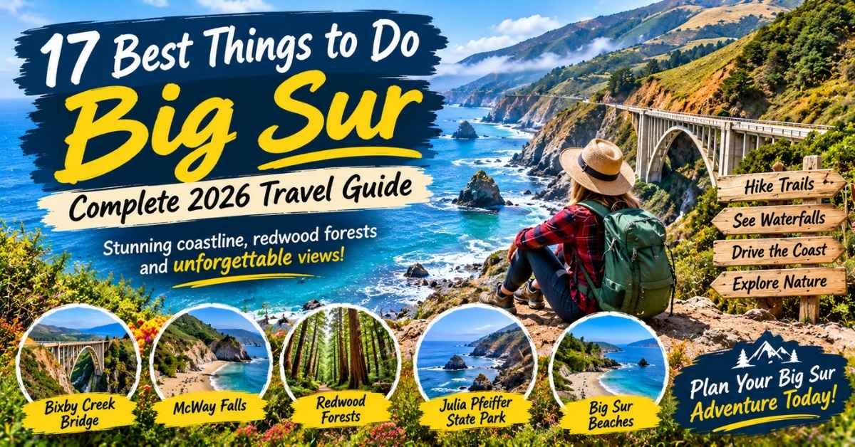
Things to do Big Sur visitors should prioritize include driving Highway 1, photographing Bixby Creek Bridge, seeing McWay Falls when its official viewpoint is accessible, exploring Pfeiffer Beach, and walking beneath coastal redwoods in an open state park. One full day is enough for four or five essential stops, but two days is ideal if you want time for hiking, beaches, wildlife, and an unhurried meal overlooking the Pacific.
Big Sur is not a compact town. It is a long, sparsely developed stretch of California coastline where the Santa Lucia Mountains meet the Pacific Ocean. Attractions are spread along a winding highway, cell service is unreliable, and access can change because of wildfire, storms, landslides, or repairs. The best trip is not the one with the most stops. It is the one that fits the open road, the weather, and your energy.
Check Current Big Sur Conditions Before You Drive
Conditions last reviewed: September 20, 2026. Highway 1 has reopened to through traffic along Big Sur, but individual parks, trails, campgrounds, and backcountry areas may remain closed or restricted after wildfire impacts.
At the time of review, Pfeiffer Big Sur State Park was closed, while designated day-use areas at Julia Pfeiffer Burns, Andrew Molera, and Limekiln had reopened. Backcountry trails east of Highway 1 remained restricted.
Never treat “Highway 1 is open” as proof that every Big Sur attraction is open. Check these official sources before leaving:
- Caltrans QuickMap for highway closures and traffic controls
- California State Parks for individual park and trail notices
- Los Padres National Forest for national forest restrictions
- CAL FIRE and Ready Monterey County for emergency information
- Big Sur Chamber of Commerce for regional Highway 1 updates
Check once when planning, again 48 hours before your trip, and once more on the morning you leave.
Big Sur at a Glance
| If you want… | Choose… | Time to allow | Main concern |
|---|---|---|---|
| The iconic first-time photograph | Bixby Creek Bridge | 15–30 minutes | Limited legal parking |
| Coastal hiking and wildlife | Point Lobos or Garrapata | 2–4 hours | Lots can fill early |
| A memorable beach | Pfeiffer Beach | 1–2 hours | Separate entrance and limited capacity |
| The famous waterfall view | McWay Falls | 30–60 minutes | Viewpoint access can change |
| Redwood scenery | An officially open redwood park | 1–3 hours | Verify park and trail status |
| Local history | Point Sur | 2–3 hours | Guided-tour schedule |
| Art and literature | Henry Miller Memorial Library | 45–90 minutes | Check opening days |
| A scenic meal | Nepenthe or another coastal restaurant | 1–2 hours | Waits and reservations |
| Oceanfront camping | Kirk Creek or another operating campground | Overnight | Advance reservation essential |
Best first visit: Combine Bixby Creek Bridge, one coastal walk, one redwood experience, McWay Falls when accessible, and either Pfeiffer Beach or a scenic meal.
Where Big Sur Begins—and Why Distance Matters
Big Sur has no universally agreed municipal boundary because it is a region rather than an incorporated city. For practical trip planning, most visitors think of it as the Highway 1 coast between the Carmel Highlands in the north and the San Carpóforo Creek or Ragged Point area in the south.
That broad interpretation covers roughly 90 miles of rugged coastline. A map may make two attractions look close, but driving takes longer than expected because of:
- Curves and narrow sections
- Road construction or one-way controls
- Slow traffic
- Fog
- Parking searches
- Viewpoint stops
- Missed turnoffs
Organize your trip geographically instead of jumping between whichever attractions appear first in a search result.
Northern Gateway
The northern section includes Point Lobos State Natural Reserve, Garrapata State Park, Soberanes Point, and Bixby Creek Bridge. It is the best area for a half-day trip from Carmel or Monterey.
Big Sur Valley
This central inland corridor includes Andrew Molera State Park, Point Sur, Pfeiffer Big Sur State Park, the Big Sur River, lodging, restaurants, and the turnoff for Pfeiffer Beach.
Central Big Sur Coast
The central coast includes Nepenthe, Henry Miller Memorial Library, Partington Cove, Julia Pfeiffer Burns State Park, and McWay Falls.
Southern Big Sur
Limekiln, Kirk Creek Campground, Sand Dollar Beach, Pacific Valley Bluff, Gorda, and Ragged Point require more driving and careful road verification.
Pfeiffer Beach, Pfeiffer Big Sur, and Julia Pfeiffer Burns
These three places are frequently confused, but they offer completely different experiences.
| Location | What it is | Visit for | Important distinction |
|---|---|---|---|
| Pfeiffer Beach | Separate coastal beach | Purple sand, Keyhole Arch, sunset | Not inside a state park |
| Pfeiffer Big Sur State Park | Inland river and redwood park | Forest walks, camping, Big Sur River | No beach or ocean access |
| Julia Pfeiffer Burns State Park | Coastal state park farther south | McWay Falls and ocean scenery | Separate entrance and operating status |
A pass or parking payment at one location may not cover another. Enter the full attraction name in your offline map and verify the correct entrance before losing cellular service.
Best Things to Do in Big Sur
1. Drive Highway 1 Slowly
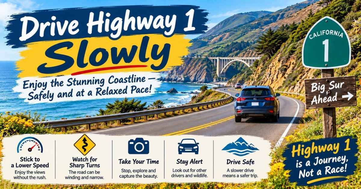
Driving California Highway 1 is the central Big Sur experience. The road curves between ocean cliffs and the Santa Lucia Mountains, shifting from exposed coastal views to shaded redwood canyons.
North-to-south travel places many ocean views on the passenger side and can simplify access to coastal pullouts. South-to-north may be more practical if you are arriving from Cambria or continuing toward Monterey. The better direction is the one that matches your overnight stop and current road access.
Do not measure the drive only by mileage. Allow time for traffic, parking, photographs, food, and unexpected closures. Never stop in a traffic lane, block an emergency area, or assume every dirt shoulder is a legal turnout.
Best for: Every first-time visitor Time needed: One full day for a meaningful scenic drive Skip when: Official warnings or closures make travel unsafe
2. Photograph Bixby Creek Bridge Responsibly
Completed in 1932, Bixby Creek Bridge is one of California’s most recognizable bridges. Its concrete arch spans a deep canyon while Highway 1 follows the cliffs above the Pacific.
The designated viewpoints can become congested, especially late morning and on weekends. Arrive early, use a legal parking space, and stay away from traffic and unstable cliff edges. If no safe space remains, continue driving. No photograph is worth blocking the road or stepping into traffic.
Morning often brings softer light and fewer people, although coastal fog may conceal the bridge. Late afternoon can provide warmer light but heavier traffic.
Best for: First-time visitors and photographers Time needed: 15–30 minutes Parking difficulty: High during peak periods Skip when: No legal space is available or fog completely obscures the bridge
3. Walk the Coast at Point Lobos
Just south of Carmel, Point Lobos State Natural Reserve is technically outside the narrowest definition of Big Sur, but it is one of the strongest gateways to the region. Coastal trails pass rocky coves, cypress groves, and wildlife-viewing areas.
You may see harbor seals, sea otters, seabirds, or migrating whales, although sightings are never guaranteed. Trail distances are adjustable, making Point Lobos useful for families, casual walkers, and experienced hikers.
The parking area can reach capacity. Arrive early and follow all roadside-parking restrictions outside the reserve.
Best for: Wildlife, coastal walking, and families Time needed: 2–4 hours Practical choice: Use Point Lobos as your main hike if you only have one day
4. Explore Garrapata State Park
Garrapata State Park combines coastal bluffs, rocky shoreline, seasonal wildflowers, and mountain-side trails. Soberanes Point offers a satisfying coastal walk without requiring an all-day hike.
Access points can be easy to miss, and facilities are limited. Download your map before arriving and avoid parking outside signed areas. Poison oak grows throughout coastal California, so remain on established trails.
Best for: Short hikes, wildflowers, and ocean views Time needed: 1–3 hours Skip when: The trail is officially closed or heavy rain has made surfaces unsafe
5. Tour Point Sur State Historic Park
The volcanic rock and lighthouse at Point Sur State Historic Park rise dramatically above Highway 1. Guided tours explain maritime history, lighthouse life, and the importance of the coast to navigation.
Tours operate on scheduled days and require walking uphill over exposed terrain. Wind can be intense, so bring layers even when the valley feels warm. Confirm schedules, physical requirements, and ticket procedures before building your day around the tour.
Best for: History lovers and lighthouse enthusiasts Time needed: 2–3 hours Planning requirement: Schedule-dependent guided access
6. Hike at Andrew Molera State Park
Andrew Molera State Park offers meadows, the Big Sur River, forest, coastal trails, and beach access. It is better suited to visitors seeking a substantial nature experience than travelers collecting quick roadside viewpoints.
Some routes may involve seasonal river conditions, mud, or longer distances. Check the official trail report, carry water, and choose a route suited to the least experienced person in your group.
Best for: Longer walks, birding, and beach hiking Time needed: 2–5 hours Skip when: You have a rushed one-day itinerary or river and trail conditions are unsuitable
7. Walk Beneath Coastal Redwoods
Big Sur is not only about ocean cliffs. Coast redwoods grow in cool canyons where streams and fog create the moisture these trees need. A forest walk gives you a quieter, more intimate side of the region.
Pfeiffer Big Sur, Limekiln, and other protected areas are often associated with redwood experiences, but fire, storm, and trail conditions can change access. Select an officially open trail on the day of your visit rather than relying on a years-old recommendation.
Redwood walks also make good alternatives when coastal fog hides the views. Carry a warm layer because shaded canyons can feel significantly cooler than sunny overlooks.
Best for: Families, nature lovers, and foggy days Time needed: 1–3 hours Expert advice: Verify the specific park and trail—not merely the highway
8. Visit Pfeiffer Beach and Keyhole Arch
Pfeiffer Beach is known for wave-shaped rock formations, patches of purple-colored sand, and Keyhole Arch. The narrow entrance from Highway 1 is easy to miss, and the access road is not suitable for every large vehicle.
Parking is limited, and vehicles may be turned away when the lot fills. The beach has a separate entrance arrangement and is not part of Pfeiffer Big Sur State Park.
Sunset draws photographers, particularly when seasonal light aligns with Keyhole Arch. Arrive well before sunset, bring layers, and avoid standing too close to the water. Big Sur’s beaches have cold water, forceful surf, and possible sneaker waves.
Best for: Photography, couples, and beach walks Time needed: 1–2 hours Not best for: Casual swimming or anyone expecting guaranteed parking
9. Slow Down for a Meal at Nepenthe
Nepenthe is as much about place as food. Its terrace sits above the Pacific, giving travelers a chance to pause instead of turning the day into a race between viewpoints.
Waits can be long at popular times. Check current hours and consider arriving outside the busiest lunch period. Budget travelers can enjoy other cafés, bakeries, or a legally permitted picnic rather than treating one famous restaurant as mandatory.
Best for: Couples, first-time visitors, and scenic dining Time needed: 1–2 hours Skip when: The quoted wait would force you to rush later stops
10. Visit the Henry Miller Memorial Library

The Henry Miller Memorial Library reflects Big Sur’s literary, artistic, and countercultural history. Its informal woodland setting, books, events, and outdoor atmosphere provide a cultural break from hiking and driving.
Opening days and events may vary. Check before arriving, especially outside peak season.
Best for: Readers, artists, and travelers seeking something beyond scenery Time needed: 45–90 minutes Weather value: A useful alternative during fog or light rain
11. Hike to Partington Cove When Open
The Partington Cove Trail descends from Highway 1 through forest and a historic tunnel toward a rocky cove. Although the route is short, the grade makes the return climb more demanding than some visitors expect.
Parking is limited, the trail can become slippery, and access may close because of wildfire or repairs. Do not attempt the route when it is officially closed.
Best for: Active visitors with limited hiking time Time needed: 1–2 hours Difficulty: Moderate because of the descent and return climb
12. See McWay Falls From the Official Viewpoint
McWay Falls descends toward a protected cove in Julia Pfeiffer Burns State Park and is one of the most famous Big Sur attractions. Visitors view it from approved overlook areas when access is open.
You cannot legally hike down to the beach or stand beneath the waterfall. The cove is protected, and unofficial descents damage fragile terrain while placing visitors at risk.
Trail and viewpoint access has changed repeatedly because of erosion, storms, repairs, and wildfire effects. Confirm the current viewing arrangement before traveling specifically for McWay Falls.
Best for: First-time sightseeing and photography Time needed: 30–60 minutes Skip when: Official access is closed; use another approved coastal viewpoint instead
13. Explore Limekiln’s Forest and History
Limekiln State Park combines redwood forest, creek environments, historic lime kilns, and coastal scenery. It offers more variety than a quick viewpoint, but trails and facilities are especially sensitive to storms and fire impacts.
Allow enough time to explore without racing daylight. Check which day-use areas and trails are operating before arrival.
Best for: History, redwoods, and a longer nature stop Time needed: 2–4 hours Planning concern: Individual trails may remain closed even when day-use areas open
14. Camp Above the Pacific at Kirk Creek
Kirk Creek Campground is famous for bluff-top campsites overlooking the ocean. Its setting creates extraordinary sunsets, but the campground offers a more rustic experience than a resort.
Reservations are highly competitive. Confirm water availability, fire rules, food-storage expectations, and road access before arrival. Never assume a roadside turnout is an acceptable backup place to sleep.
Best for: Campers comfortable with limited services Time needed: At least one night Book early: This is one of the experiences most likely to require advance planning
15. Walk Sand Dollar Beach
Sand Dollar Beach is one of the broader and more recognizable beaches along the southern Big Sur coast. Visitors descend from the bluff by stairs, making it less suitable for some mobility needs.
The beach is excellent for walking, photography, and watching experienced surfers. It should not be treated as a guaranteed safe swimming beach. Check tides, remain alert for powerful waves, and keep children close.
Best for: Beach walks and southern-coast scenery Time needed: 1–2 hours Safety concern: Cold water, surf, stairs, and changing tides
16. Walk Pacific Valley Bluff
The Pacific Valley Bluff Trail offers expansive coastal scenery with relatively modest effort when the area is officially open. It works well for non-hikers who want space to walk without committing to a steep canyon trail.
Wind exposure can be significant, and there are few services nearby.
Best for: Non-hikers, wildflowers, and flexible southern stops Time needed: 30–90 minutes
17. Watch Wildlife Without Disturbing It
Big Sur lies within a rich coastal ecosystem. Depending on the season and luck, you may see California condors, sea otters, harbor seals, gray whales, humpback whales, or seabirds.
Carry binoculars and observe from a distance. Never feed wildlife, approach resting marine mammals, or cross barriers for a photograph.
The Piedras Blancas elephant seal rookery near San Simeon is a valuable southern extension, but it sits beyond the core Big Sur region.
Learn More: 17 Best Things to Do in Idaho City: 2026 Travel Guide
Best Big Sur Attractions Compared
| Attraction | Best for | Time | Effort | Parking pressure | Main variable |
|---|---|---|---|---|---|
| Bixby Creek Bridge | Iconic photographs | 15–30 minutes | Easy | High | Fog and parking |
| Point Lobos | Hiking and wildlife | 2–4 hours | Adjustable | High | Park capacity |
| Garrapata | Bluff walks | 1–3 hours | Easy–moderate | Moderate | Trail status |
| Pfeiffer Beach | Sunset and photography | 1–2 hours | Easy | High | Wind and capacity |
| Andrew Molera | Longer nature outing | 2–5 hours | Moderate | Moderate | River and trails |
| Point Sur | History | 2–3 hours | Moderate | Tour-based | Schedule |
| McWay Falls | Waterfall view | 30–60 minutes | Easy when open | High | Viewpoint access |
| Partington Cove | Short adventure | 1–2 hours | Moderate | Limited | Closure status |
| Limekiln | Redwoods and history | 2–4 hours | Moderate | Moderate | Trail access |
| Henry Miller Library | Culture | 45–90 minutes | Easy | Low–moderate | Opening days |
Best Big Sur Hikes by Difficulty
Easy and Lower-Effort Walks
Choose adjustable coastal paths at Point Lobos, Pacific Valley Bluff, or an officially open developed redwood trail.
Distance alone does not determine accessibility. Check surfaces, stairs, slopes, and restroom availability before visiting.
Moderate Hikes
Soberanes Point, selected Andrew Molera routes, and Partington Cove provide more physical challenge without requiring a remote expedition. Expect exposed terrain, mud, roots, or steep grades depending on the route.
Strenuous Backcountry Routes
Ventana Wilderness and Pine Ridge or Sykes-area travel require more preparation. Visitors must consider navigation, water treatment, heat, poison oak, fire restrictions, overnight regulations, and limited communication.
Do not enter a closed backcountry area because an older article or saved map shows a trail. Official restrictions override every itinerary.
Things to Do in Big Sur Without Hiking
You can enjoy Big Sur without completing a demanding trail. Build a low-exertion day around:
- Highway 1 scenery
- Bixby Creek Bridge
- Approved coastal viewpoints
- Henry Miller Memorial Library
- A scenic meal
- Point Sur when its walking requirements suit you
- Wildlife watching with binoculars
- Short developed walks in an operating park
Accessibility differs dramatically between attractions. Confirm parking surfaces, stairs, grades, restroom access, and viewpoint distance with the individual land manager.
Things to Do in Big Sur With Kids
Children usually enjoy Big Sur most when the day alternates between short walks, wildlife, food, and open space.
Good family choices include:
- Adjustable trails at Point Lobos
- An officially open redwood walk
- Bixby Creek Bridge from a safe viewpoint
- A picnic in an approved day-use area
- Wildlife observation
- A short beach walk under safe conditions
Bring snacks, water, layers, and motion-sickness supplies. Restrooms and food are not available at every stop. Supervise children closely near highways, cliffs, rivers, and waves.
Romantic Things to Do in Big Sur
For couples, the most memorable itinerary is usually slower rather than fuller. Walk beneath redwoods, share a long coastal lunch, photograph the changing fog, or watch sunset from an approved viewpoint.
Pfeiffer Beach can be romantic, but sunset also brings crowds and uncertain parking. Luxury resorts offer memorable settings, yet a picnic and quiet morning walk can create an equally meaningful experience without the price.
Free and Low-Cost Big Sur Activities
You do not need a luxury-resort budget to experience Big Sur.
- Drive Highway 1
- Use legal public viewpoints
- Photograph Bixby Creek Bridge
- Walk approved public trails
- Watch wildlife
- Visit accessible public beaches
- Pack a picnic
- Explore Henry Miller Memorial Library when open
Parking, day-use, or separate entrance fees may still apply. A sensible budget plan is to choose one paid anchor experience and organize free scenic stops around it.
What to Do When Big Sur Is Foggy or Rainy
Fog is part of the Big Sur landscape, especially during summer mornings. Instead of waiting at an invisible viewpoint, visit redwoods, the Henry Miller Memorial Library, a café, or another inland attraction. Coastal visibility may improve later.
Rain requires more caution. Trails become slippery, creeks rise, rockfall risk can increase, and road conditions may change quickly. Waterproof boots do not make a closed or unsafe trail appropriate.
Change or cancel the plan when officials issue closure, evacuation, flooding, landslide, or fire warnings.
Best Time to Visit Big Sur
Spring
Spring may bring green hills, wildflowers, active waterfalls, rain, mud, and road-repair activity. It is beautiful but changeable.
Summer
Summer offers long daylight and high demand. Morning fog is common, campsites fill early, and popular parking areas become congested.
Fall
Fall can bring clearer skies and warm afternoons, but shorter daylight and wildfire risk require attention.
Winter
Winter generally brings fewer crowds and dramatic weather. It also carries greater potential for rain, slides, trail damage, and temporary road closures.
There is no universally perfect month. Choose the season that best matches your tolerance for crowds, fog, rain, and access uncertainty.
See More: 25 Best Things to Do in Vermont in Summer (2026 Guide)
One-Day Big Sur Itinerary
Morning
Leave Carmel or Monterey early. Choose a meaningful coastal walk at Point Lobos or Garrapata, then stop at Bixby Creek Bridge only if legal parking is available.
Midday
Continue into Big Sur Valley. Choose one officially open redwood experience and eat lunch without turning the meal into a rushed fuel stop.
Afternoon
Visit McWay Falls if the approved viewpoint is open. Add either Partington Cove, a cultural stop, or another coastal viewpoint—not all three.
Evening
Choose Pfeiffer Beach or a scenic dinner. Consider darkness, fog, fatigue, and your comfort level before committing to a late return drive.
What to cut when delayed: Remove the farthest stop, not the meal or safety buffer.
Two-Day Big Sur Itinerary
Day One: Northern Coast and Big Sur Valley
- Point Lobos or Garrapata
- Bixby Creek Bridge
- Point Sur or Andrew Molera
- An open redwood trail
- Dinner or lodging in the Big Sur area
Day Two: Central or Southern Coast
- Henry Miller Memorial Library
- McWay Falls when accessible
- Partington Cove or Limekiln
- Sand Dollar Beach or Pacific Valley Bluff
- Return before dark or stay farther south
If southern access is interrupted, use the second day for northern trails, culture, and a slower valley experience.
Three-Day Big Sur Itinerary
Day one: Explore Point Lobos, Garrapata, and Bixby Creek Bridge.
Day two: Focus on Big Sur Valley, redwoods, Point Sur, local culture, and a scenic meal.
At Day three: Follow current access toward McWay Falls, Limekiln, Sand Dollar Beach, and southern viewpoints.
Keep half a day flexible for weather or closures. That flexibility is more valuable than adding another reservation.
Planning From Different Starting Points
From Carmel or Monterey
These are the easiest bases for a one-day Big Sur trip. They provide restaurants, lodging, fuel, and quick access to the northern coast.
From San Francisco
Big Sur is possible as a very long day trip, but an overnight stay creates a safer and more enjoyable experience. Do not underestimate the return drive after dark.
From Cambria or San Luis Obispo
Approach from the south and prioritize Ragged Point, Sand Dollar Beach, Limekiln, and other accessible southern attractions. Verify through-access before assuming you can reach Carmel.
From Los Angeles
Treat Big Sur as a multi-day coastal road trip rather than a comfortable same-day excursion. Cambria or San Luis Obispo can serve as a useful overnight base.
Where to Stay
Inside Big Sur
Stay inside the region for immersion, sunrise and sunset access, romantic lodging, and reduced daily commuting. Expect higher prices, limited inventory, fewer services, and weak cell coverage.
Carmel or Monterey
Choose Carmel or Monterey for more hotel and restaurant options, family convenience, and easy northern Big Sur access.
Cambria or San Simeon
These locations work well for southern Big Sur, Hearst Castle, and the elephant seal rookery.
Before booking, compare parking, cancellation policies, minimum stays, accessibility, meal availability, and the effect a highway closure would have on your route.
Camping in Big Sur
Big Sur contains state-park, national forest, and private campgrounds, but demand regularly exceeds supply. Reserve early and monitor cancellations.
Confirm:
- Fire and stove restrictions
- Drinking-water availability
- Food-storage requirements
- Vehicle-size limits
- Check-in rules
- Road access
- Closure and refund policies
Sleeping in a roadside turnout is not a safe or responsible substitute for a legal campsite.
Driving, Parking, Gas, and Cell Service
Driving
Highway 1 is slow, curved, and exposed. Use designated pullouts to allow faster traffic to pass. Avoid driving while distracted by the view.
Parking
Use developed lots and clearly legal turnouts. Do not block private driveways, emergency access, traffic lanes, or narrow shoulders. When a stop is full, continue to the next destination.
Fuel and Charging
Fill your tank in Carmel, Monterey, Cambria, or another service center before entering remote sections. Fuel within Big Sur is limited and often more expensive.
EV drivers should confirm compatible chargers and maintain a generous range buffer.
Cell Service
Cellular coverage is unreliable. Download offline maps, screenshot reservations and directions, save emergency information, and carry a charged power bank.
Food, Water, and Restrooms
Carry water and basic food. Confirm restaurant hours rather than assuming the next location will be open. Use developed restroom facilities when available and pack out all waste.
Big Sur Beach and Trail Safety
Big Sur beaches can have cold water, strong currents, sneaker waves, unstable rocks, and limited lifeguard coverage. Treat them as wild coastal environments rather than guaranteed swimming beaches.
On trails:
- Watch for poison oak and ticks
- Carry water and layers
- Stay on approved routes
- Turn around before darkness
- Avoid unstable cliff edges
- Do not cross barriers
- Tell someone your backcountry plan
- Follow every fire and closure order
Responsible Big Sur Travel
Big Sur’s beauty depends on visitors making careful choices.
- Park legally
- Respect private property
- Stay behind barriers
- Pack out trash
- Follow fire restrictions
- Keep your distance from wildlife
- Avoid unauthorized cliff paths
- Keep emergency lanes clear
- Support local businesses
These are not abstract rules. They protect residents, emergency access, fragile habitats, and the landscapes you traveled to see.
Use the Big Sur Five-Question Filter
Before adding any stop, ask:
- Is it officially open?
- Does it fit my driving direction?
- Can I park legally?
- Does it match my group’s physical ability?
- Is it worth the time it will replace?
Suppose you have one afternoon and must choose between Point Lobos, Pfeiffer Beach, and a southern attraction. Point Lobos is the strongest choice for hiking and wildlife near Carmel. Pfeiffer Beach is better for sunset if the lot is accepting vehicles. A southern stop only makes sense if road access, daylight, and your final destination support the extra drive.
Common Big Sur Planning Mistakes
Trying to See Everything
Five well-chosen stops create a better day than twelve rushed pullouts.
Treating Big Sur Like a Small Town
Attractions stretch across many miles. Organize them by geographic zone.
Relying Only on Google Maps
Navigation apps do not replace Caltrans, park, fire, or emergency notices.
Confusing the Pfeiffer Attractions
Pfeiffer Beach, Pfeiffer Big Sur State Park, and Julia Pfeiffer Burns State Park have separate locations and purposes.
Parking Wherever Space Appears
An empty shoulder is not automatically a legal or safe parking place.
Planning Sunset Without Planning the Return
After sunset, darkness, fog, curves, wildlife, and fatigue make the return drive more demanding.
Trusting an Old Guide Over a Current Closure
Official restrictions always override blogs, saved maps, and social-media posts.
What to Book in Advance
Book early when your trip depends on:
- Big Sur lodging
- Campgrounds
- Scheduled Point Sur tours
- Special-occasion restaurants
- Retreats or guided experiences
Keep roadside viewpoints, weather-dependent beaches, and self-guided walks flexible. That flexibility allows you to respond to fog, traffic, and closures without losing money.
Frequently Asked Questions
What are the best things to do in Big Sur?
The best things to do in Big Sur are driving Highway 1, photographing Bixby Creek Bridge, seeing McWay Falls when accessible, visiting Pfeiffer Beach, walking beneath redwoods, and exploring an open coastal park such as Point Lobos, Garrapata, or Andrew Molera.
Is Big Sur worth visiting?
Yes. Big Sur is worth visiting for its coastal cliffs, redwoods, waterfalls, beaches, wildlife, Highway 1 scenery, and unusual combination of wilderness and cultural history.
How many days do you need in Big Sur?
Plan one day for essential viewpoints, two days for a balanced first visit, or three days for hiking, southern attractions, and weather flexibility.
Can you visit Big Sur in one day?
Yes, but limit the day to four or five major stops. Begin early and avoid driving the entire coast simply to collect locations.
Is Highway 1 open through Big Sur?
Highway 1 was open to through traffic when this guide was reviewed on September 20, 2026. Conditions can change quickly, so verify the route through Caltrans QuickMap on the day you travel.
Which direction should you drive through Big Sur?
North-to-south travel places many ocean viewpoints on the right side of the road. South-to-north is practical when arriving from Cambria or continuing toward Monterey. Current access and your overnight location matter more than a universal rule.
Is Big Sur free to visit?
Driving Highway 1 and using many public viewpoints are free. State parks, parking areas, Pfeiffer Beach, tours, and campgrounds may charge fees.
Do you need reservations for Big Sur?
You generally need advance reservations for popular lodging, campgrounds, scheduled tours, and some restaurants. Most roadside viewpoints do not accept reservations.
Can you visit Big Sur without hiking?
Yes. You can drive Highway 1, see Bixby Creek Bridge, use approved viewpoints, visit cultural attractions, enjoy a scenic meal, watch wildlife, and take short developed walks.
Can you swim at Big Sur beaches?
Some people enter the water, but Big Sur beaches often have cold water, strong currents, and sneaker waves. Check local warnings and do not assume a beach is safe for casual swimming.
Can you walk down to McWay Falls?
No. The beach beneath McWay Falls is protected and closed to public access. View the waterfall only from officially open overlooks.
Is Pfeiffer Beach inside Pfeiffer Big Sur State Park?
No. Pfeiffer Beach has a separate access road and entrance arrangement. Pfeiffer Big Sur State Park is an inland redwood and river park without direct beach access.
Does Big Sur have cell service?
Coverage is unreliable. Download maps and save reservations, directions, and emergency information before entering the region.
What should you do if Highway 1 closes?
Do not attempt to bypass a closure. Build a northern itinerary from Carmel or a southern itinerary from Cambria, depending on which side remains legally accessible.
Make Your Big Sur Trip Count
For a rewarding first visit, choose one coastal walk, Bixby Creek Bridge, an open redwood experience, McWay Falls when accessible, and either Pfeiffer Beach or a scenic meal. That combination captures Big Sur’s cliffs, forests, culture, and slower rhythm without turning your day into a driving contest.
Before leaving, complete three steps: check official road and park conditions, reserve the experience you would be most disappointed to miss, and download your route for offline use.
Big Sur is most powerful when you leave space for fog, silence, and the unexpected view that makes you stop—legally, safely, and without rushing onward.